Lovely azaleas

Lovely azaleas
Pixabay Public Domain

Jun 16, 2013

PATAGONIAN ICE FIELDS AND GLACIERS OF CHILE


WELCOME TO THIS BLOG POST!


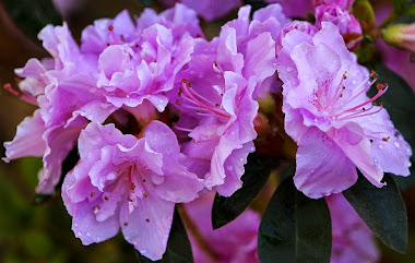
AN INTERESTING AND COLORFUL FLOWER FOR MY READERS

 THIS IS THE NOTRO, AN INDIGENOUS PLANT!


 Click to enlarge


Source: Javier Martin, CC BY SA 3.0. Wikimedia Commons


A NOTRO TREE, GROWING NEAR THE GREY GLACIER


 Click to enlarge


Source: Liam Quinn, CC BY SA 2.0. Wikimedia Commons 


THE PATAGONIAN ICE FIELDS.


Chile is a country of contrasts. The Far North Region is a desert, the Far South Region (Chile Austral), shows remnants of an ice age with the presence of some impressive Ice Fields.

At present, geographers define the Patagonian Ice fields as remnants of the Patagonian Ice sheet, which covered all of southern Chile during the last glacial period or Quaternary glaciation, which in this area receives the name of Llanquihue glaciation.

There is a Northern Patagonian Ice Field, which is the smaller of the two remaining parts of the Ice sheet, and a Southern Patagonian Ice Field, which is the world’s second largest field.

These two Ice Fields feed many glaciers, some of which are mostly contained within the boundaries of Argentina, and many of which flow towards the western area of the Andes, on the Chilean side.

From the 16th to the 19th century, several areas of the world went through what is known as the Little Ice Age, which certainly affected Europe, and also appears to have had its effects on the Patagonian Area of the Far South of Chile. During this period, the glaciers reached their largest extension, but sadly have been shrinking ever since.

In recent years, this shrinkage has been accelerating due to global warming, and is causing concern because these are an important part of the planet’s reserves of fresh water, and also because they are a factor in the rising sea levels.

The Northern Patagonian Ice Field is contained within the boundaries of the Laguna San Rafael National Park, and is therefore a protected area. 

Some of the more important glaciers in this park are the following: Colonia, Nef, San Quintin and San Rafael. The most famous is the San Rafael, which flows into the San Rafael Lagoon.

MAP OF THE NORTH ICE FIELD


 Click to enlarge

Source: NASA, Public Domain, Wikimedia Commons


The Southern Ice Fields are protected in part by the Bernardo O’Higgins National Park and the Torres de Paine National Park. These are administrated by Chile.

There is another park on the Argentinean side, called Los Glaciares National Park.

Some of the important Chilean glaciers in the Southern Fields are: Amalia, Bernardo, Grey, Jorge Montt and O’Higgins. Most of these flow into the fjords of the Patagonian channels of the Pacific Ocean.


PART OF THE SOUTH ICE FIELD, SEEN BY NASA


 Click to enlarge

Source: NASA, Public Domain, Wikimedia Commons


This is a particularly clear photo of the glacier formation, well with a look!


VIEWS OF SOME OF THE GLACIERS.


SAN RAFAEL


An important glacier in the Northern Patagonian Ice Field, it can be seen on the map that follows. The San Rafael Lagoon is visited by thousands of tourists who travel there mostly on the Skorpios ships, a tourist line set up specifically for this purpose.

The highlight of the tour is to drink “whisky on the rocks” with real ice taken from the glacier.

LAGOON AND GLACIER AT SAN RAFAEL


Click to enlarge

  
Source: Ralf Peck, CC BY 2.0. Wikimedia Commons


THE SAN RAFAEL LAGOON


 Click to enlarge

Source: Vincent Hueng, CC BY 2.0. Wikimedia Commons

SAN RAFAEL ICEBERG


 Click to enlarge


Source: Vince Hueng, CC BY 2.0. Flickr 


GREY GLACIER
 

This one is famous for its connection to the Torres de Paine, a wonder of the world, also a Chilean national reserved area.

Thousands of international tourists visit these wonderful locations every year.

A SUPERB VIEW BY NASA OF THE GREY GLACIER!


 Click to enlarge


Source: NASA, Public Domain, Wikimedia Commons 

ICEBERGS AT GREY GLACIER


 Click to enlarge


Source: Dimitry B. CC BY 2.0. Flickr


 JORGE MONTT GLACIER 


Another famous glacier in the Southern Fields. Unfortunately, its fame is based on the fact that it is the one that shows the fastest rate of shrinkage to date. How sad!

JORGE MONTT GLACIER, AN IMPRESSIVE VIEW!


 Click to enlarge

Source: NASA, Public Domain, Wikimedia Commons


O’HIGGINS GLACIER 


It is one of the largest in Chilean Patagonia, and flows towards the O’Higgins Lake.


A REALLY BEAUTIFUL VIEW OF THE O'HIGGINS GLACIER!


Click to enlarge

Source: Roberto Araya B., CC BY SA 3.0. Wikimedia Commons


FINAL WORDS


Tourism in these areas has only started up a few years ago, so most of these scenes are still practically virgin territory.

The climate is harsh, but the scenic views are well worth the effort! So, happy visiting!


SPANISH VERSION


(This Blog is bilingual)


En este post presento una de las zonas menos conocidas de Chile, esto es, Chile Austral.

Se distinguen principalmente los llamados Campos de Hielo, a saber: Campos de Hielo Norte y Campos de Hielo Sur.

En ambos sectores se destacan numerosos glaciares o ventisqueros, los cuales lamentablemente están sufriendo el embate del calentamiento global.

En efecto, desde el siglo 20 han empezado a retroceder notoriamente, siendo el que más intensamente presenta este fenómeno, el Ventisquero Jorge Montt, ubicado en los Campos de Hielo Sur.

Este fenómeno es preocupante, por cuanto esta área es una de las importantes reservas de agua dulce del planeta, y además, el rápido deshielo está influyendo en el aumento de los niveles de los océanos. Es de esperar que este fenómeno se pueda detener de alguna manera.

En el post se establece que los Campos de Hielo, tanto el  Norte como el Sur, se ubican al interior de áreas reservadas estructuradas como Parques Nacionales. Esto indudablemente ayuda a su preservación.

Una parte importante de este post lo constituyen las imágenes seleccionadas con el fin de mostrar la grandiosidad de estos panoramas. Las imágenes hablan por si solas, y no es necesario detallar estos elementos en la traducción al Español.


Espero que disfruten de este post!


More about similar topics in a future post.      Más sobre temas similares en un próximo post.


How is your level of comprehension?      ¿Cómo está su nivel de comprensión?


© 2013  jveronr  (Joan Robertson)


I will be very happy to receive your comments! Just click the word “comments” lower down.


Jun 9, 2013

GEOGRAPHIC REGIONS OF CHILE


WELCOME TO THIS POST!

A LOVELY FLOWER FOR MY READERS!

The Iris "Halo in Peach"


Click to enlarge


Source: Korlan, CC BY SA 3.0. Wikimedia Commons 


Chile, the string-bean country on the west side of South America’s Southern Cone, has an extremely diverse geography.


CONTINENTAL CHILE


Continental Chile extends from latitude 17º south all the way to Cape Horn at 56º south, a distance of about 4,270 km or 2,653miles. That’s a really long distance which also provides Chile with an extensive coast line.


The extraordinary thing is that the average width from east to west is only 177 km or 110 miles!


Because of its various distinct geographic features, the country divides easily into five natural regions:

  • The Far North (Norte Grande)

  • The Near North (Norte Chico)

  • Central Chile (Zona Central)

  • The South of Chile (Zona Sur, or Sur de Chile)

  • The Far South (Chile Austral)

 
THE FAR NORTH (NORTE GRANDE)

 CHAJNATOR PLATEAU


 Click to enlarge


 Source: ESO, CC BY 3.0. Wikimedia Commons


ICY PENITENTS ON CHAJNATOR


Click to enlarghe


Source: ESO,CC BY 3.0. Wikimedia Commons


From the northern limit with Peru to the Copiapó River, the climate is very dry as most of this region is covered by the Atacama Desert; the coast range is high and borders the coast line with many cliff formations. 


This region also includes a part of the Altiplano or Andes Plateau (High Plateau), and the Andes range is at its highest with peaks like Ojos del Salado at 6,891 m.


THE NEAR NORTH (NORTE CHICO)


SCENE FROM NORTE CHICO 

Click to enlarge


Source: VivisCarvalho, CC BY SA 2.0. Flickr


ELQUI VALLEY


Cick to enlarge

Source: ZKP, CC BY SA 2.5 Wikimedia Commons


From the Copiapó River to the Aconcagua River, the climate is semi-arid as the Atacama Desert starts to transition into a more Mediterranean profile. 


In the more southern portion of this region, the Andes and the coast range are joined by a series of short hilly ranges that run from east to west.


The valleys that form in between these short ranges are irrigated by various rivers that flow down from the Andes towards the coast. They are known as the Transverse Valleys. The Elqui Valley is the most well known.


CENTRAL CHILE (ZONA CENTRAL)


VINEYARDS IN CENTRAL CHILE

Click to enlarge


Source: Beatrice Murch, CC BY SA 2. Wikimedia Commons


COASTAL BLUFFS IN CENTRAL CHILE


 Click to enlarge


Source: Jason Hollinger, CC BY 2.0. Wikimedia Commons 


From the Aconcagua River to the Biobio River, this region has a Mediterranean climate and characteristic Matorral vegetation.


The Andes and the coast range are separated by the Intermediate Depression that is known also as the Central Valley. It is a fertile region that is rich in agricultural products.


THE SOUTH OF CHILE (SUR DE CHILE)

LOOKIN OUT OVER LAKE CONGUILLIO

Click to enlarge

Source: SarahandIain, CC BY 2.0. Wikimedia Commons


LAKE LLANQUIHUE, WITH OSORNO VOLCANO


Click to enlarge

Source: GatoOH, CC BY SA 3.0. Wikimedia Commons


From the Biobio River to the Chacao Channel, this region has a temperate oceanic climate which has produced several interesting rain forests.  


The coast range is lower and the Andes are less massive but include many volcanoes; there are also numerous hot springs.


The Intermediate Depression comes closer to sea level and shows several beautiful glacial lakes. This is the famous Lake District of Chile.


THE FAR SOUTH (CHILE AUSTRAL)

TORRES DEL PAINE FROM LAKE PEHOE


Click to enlarge


Source: Miguel Vieira, Public Domain, Wikimedia Commons 


TORRES DEL PAINE

Click to enlarge

Source: Alex Promois, CC by 2.0. Wikimedia Commons


From the Chacao Channel to the southernmost tip of the continent at Cape Horn, this region has a sub polar oceanic climate and Magellanic vegetation.


The coast range shows its last peaks in the form of the more northern islands of this region.


The Intermediate Depression disappears under the sea and the Andes range takes up most of the remaining space, forming innumerable islands, channels and fjords. 


This region includes the famous Straits of Magellan and the Beagle Channel. These waterways have witnessed a lot of history through the ages.


MORE CHILEAN REGIONS


The regions described above correspond to the mainland area of Chile. There are also two more geographic regions:

  • Insular Chile which includes various Pacific islands that are under Chilean administration. The most important of these is Easter Island.

  • Chilean Antarctica, where Chilean claims have as yet not been ratified. If they ever were to be ratified, Chile would extend to the South Pole.

 
SPANISH VERSION


(This Blog is bilingual)


La geografía de Chile presenta una gran diversidad debido a su larga extensión en la costa occidental del Cono Sur de América del Sur.


CHILE CONTINENTAL


Chile continental se extiende desde la latitud 17º sur hasta el Cabo de Hornos en la latitud 56º. Esta larga distancia provee a Chile de una línea costera realmente impresionante, son sobre 4.000 km de costa frente al Océano Pacífico.


Como característica extraordinaria, el ancho promedio de Chile ¡no supera los 177 km! Es realmente ¡una larga y angosta faja de tierra…!


Desde el punto de vista de su geografía física, el país se divide en cinco regiones naturales claramente distinguibles, a saber:

  • Norte Grande

  • Norte Chico

  • Zona Central

  • Sur de Chile

  • Chile Austral


NORTE GRANDE.


Se extiende desde el límite norte con el Perú hasta el Rio Copiapó. El clima es desértico y la mayor parte de esta zona corresponde al Desierto de Atacama; la cordillera de la costa es bastante alta y bordea la costa en forma de acantilados


Esta región incluye una parte del Altiplano Andino y la Cordillera de los Andes muestra su formación más alta en Ojos del Salado (6.891 m)


NORTE CHICO


Se extiende desde el Río Copiapó hasta el Río Aconcagua. El clima es semi-árido y se produce una transición del Desierto de Atacama hacia un perfil más Mediterráneo.


En la parte sur de esta región se presentan los llamados Valles Transversales, que se caracterizan por contar con cortas cadenas de cerros que unen los Andes con la costa, dejando entre ellas valles por donde fluyen los ríos que los fertilizan. El más conocido es el Valle de Elqui.


ZONA CENTRAL.


Se extiende desde el Río Aconcagua hasta el Rio Biobio. Tiene un clima Mediterráneo y su vegetación característica es el Matorral.


La cordillera de la costa y la Cordillera de los Andes se encuentran separados por el Valle Central o Depresión Intermedia. Es una fértil zona de grandes extensiones de producción agrícola.


SUR DE CHILE


Se extiende desde el Río Biobio hasta el Canal del Chacao. Tiene un clima oceánico templado e incluye numerosos bosques pluviales.


La cordillera de la costa es más baja y la Cordillera de los Andes ya no es tan masiva pero sí incluye numerosos volcanes y lugares con aguas termales.


La Depresión Intermedia se acerca al nivel del mar y muestra varios lagos muy hermosos que se originan en los deshielos. Este es la famosa zona de los Lagos de Chile.


CHILE AUSTRAL.


Se extiende desde el Canal del Chacao hasta el extremo del continente, en el Cabo de Hornos. Esta zona tiene clima oceánico subpolar y su vegetación se clasifica como Magallánica.


La cordillera de la costa muestra sus últimas alturas en la formación de algunas islas, para luego desaparecer definitivamente.


La Depresión Intermedia se hunde en el mar y sólo predomina la Cordillera de los Andes, que permanece en la forma de innumerables islas rodeadas de canales y fiordos.


En esta última región se ubican el Estrecho de Magallanes y el Canal de Beagle, vías de navegación que han visto el acontecer de la historia a través del tiempo.


MÁS REGIONES DE CHILE


Las zonas descritas más arriba corresponden a Chile Continental.

También se pueden mencionar:

  • Chile Insular, que incluye varios conjuntos de islas en el Océano Pacífico frente a Chile

  • Chile Antártico. Chile reclama una extensa zona de la Antártica, pero su posesión no ha sido ratificada internacionalmente. Si en algún momento esto se oficializa, Chile se extendería hasta el Polo Sur.


More about similar topics in a future post.   Más sobre temas similares en un próximo post.


LANGUAGE TIPS FOR ENGLISH


Words that go together!  * Early 19th century   - * Draw attention to  - * Go dark 


LANGUAGE TIPS FOR SPANISH.


Expresiones de uso frecuente: * Los genios pensamos igual - * Más vale dar que recibir  - * No dan a quien no acude 


How is your level of comprehension?   ¿Cómo está su nivel de comprensión?


© 2013  jveronr  (Joan Robertson)


I will be very happy to receive your comments! Just click the word “comments” lower down.